Start Asset Defects Survey
Where a device has no GPS capability HighLight can still be used for all data collection. Location details can be provided by the User through other means: external GPS device, network marker posts, node points and survey wheel etc. The survey can be 'stepped through' using the 'stepper' buttons oulined below:
These are shown here as <<, <, > and >> and perform the following actions:
-
<< Move the cursor back to the Previous Chart Section in the list.
- < Move the current location Back 100m within the current Chart Section. This actions rounds back to the last 100 multiple, and then down in 100m steps back to zero. By default this works on the in Section Chainage.
- > Move the current location Forward 100m within the current Chart Section. This actions rounds forward to the next 100 multiple, and then up in 100 m steps to the overall section length. By default this works on the in Section Chainage.
- >> Move the cursor forward to the Next Chart Section in the list. Whilst the current display shuffles within the current Chart Section
The User may opt to use these step command buttons to record the survey progress, semi-automatically recording Started and Finished times and moving through the Chart Section list as the buttons are clicked and progress along the route is triggered.
To begin the survey, Select 'Start Survey' from the Survey Menu.
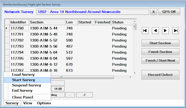
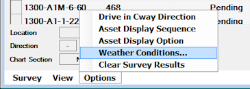
This will initiate the standard Survey Conditions prompts for weather, road surface condition etc. The prompt will be offered automatically at the start of the survey and can then be accessed on demand to reflect any changes in conditions, road surface condition etc.
The below display shows the HighLight panel partway through a Survey run.
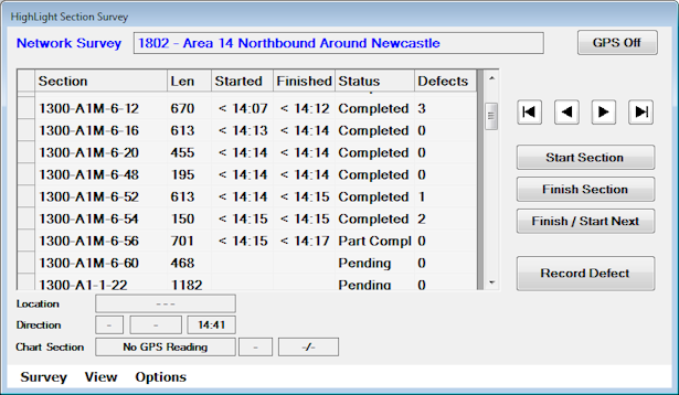
The above image was taken without a live GPS connection, hence it shows as GPS Off, and there is no display for Grid Reference Location, Direction and Speed in the display fields.